The ancient story of the boy who cried wolf still communicates an essential truth. In a crisis, false alarms – even those sent with the best of intentions – can be just as dangerous as the emergency itself.
When information defines the line between safety and harm, an emergency alert sent to the right people at the right time is more than words. It’s survival.
Think of a broad, city-wide blast for a highly localized tornado, causing unnecessary panic. Highways clog and cell phone towers flood, leaving impacted neighborhoods stranded and isolated. The next time an emergency occurs, your community may be more likely to ignore the alert rather than take it seriously.
If mismanaged or sent to the wrong people, mass notifications can actually do more harm than good. Success in emergency response is about relevance, not volume.
That’s why many modern emergency notification systems now prioritize location-based precision. We’ll go over why sending broad messages creates noise, while precision-targeting ensures only those at risk get the alert.
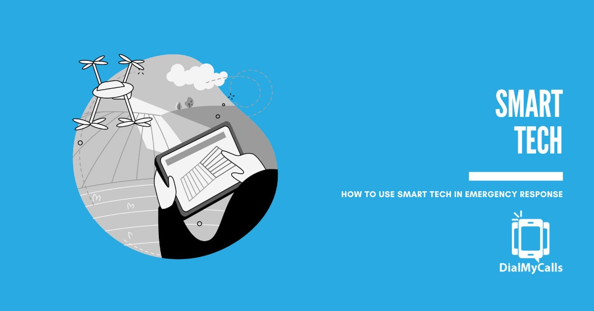
Then we’ll take a look at the technology behind that precision: Geographic Information Systems (GIS), geofencing, and dynamic boundaries that work together to map out danger in real-time.
The most effective mass notifications give people specific instructions based on exactly where they are. By cutting through the noise of the chaos, geo-targeted alerts make sure your community is not only informed, but safer.
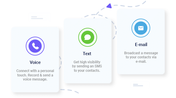
Keep Everyone Connected & Informed
Get the Word Out Quickly with Bulk Texting and Voice Calls
During the 2017 California wildfires, many agencies relied on older systems that lacked precise geo-targeting. Mass notifications were often sent to entire counties rather than specific impacted neighborhoods. As a result, people switched off emergency alerts on their phones.
If someone three towns over gets a “Shelter in Place” order meant for a specific downtown block, they’ll eventually start tuning you out. Over-alerting is the main reason people disable emergency notifications on their phones.
According to the Federal Communications Commission (FCC), citizens proactively disabling Wireless Emergency Alerts (WEA) to avoid irrelevant disruptions, known as warning fatigue, is a major complication in emergency response.
When communities receive frequent warnings that don’t result in local impact, they develop a cry wolf syndrome. If they don’t ignore your alert completely, they may waste seconds and minutes looking for a second source of confirmation rather than seeking shelter immediately. This confirmation time is known as milling time, a key metric the FCC uses to determine the effectiveness of emergency response.
Over-alerting can also create confusion that paralyzes safety response. Beyond just being annoying, over-alerting creates a fog of war that can physically obstruct emergency operations.
When a notification is sent to a population that doesn’t need to take action, it triggers a chain reaction of unnecessary behavior. People who are safe may clog emergency phone lines asking for clarification, or worse, they may take to the roads in a shadow evacuation. Those fleeting a non-threatened area inadvertently gridlock the very routes that first responders need to reach the actual disaster zone.
Consider a hypothetical chemical leak at an industrial plant. If a mass “Evacuate Now” text message is sent to the entire city rather than the specific downwind neighborhoods, thousands of people who are perfectly safe will flood the highways. This creates a massive bottleneck that prevents ambulances and fire trucks from reaching the plant.
In this case, over-alerting spread fear, and created a physical barrier to life-saving aid. Precision ensures that those who need to move can do so, while those who are safe stay off the roads, keeping the lifelines open for responders.
The margin for error in a crisis is usually measured in seconds. If an alert is too broad, you create unnecessary panic. If it’s too narrow, you leave people in harm’s way.
Targeted alerts give people a clear path to safety. If they get the alert, they know they’re in the zone. Milling time cuts down. Your team receives the assurance that people are safe, and unnecessary panic hasn’t spread.
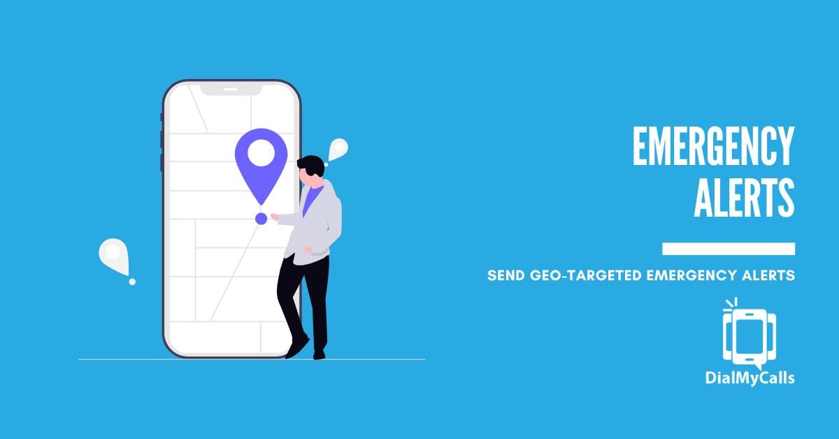
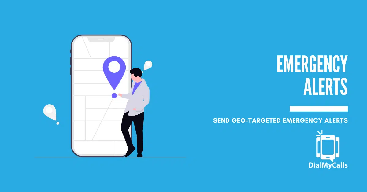
What Are Geo-Targeted Emergency Alerts?
Geo-targeted emergency alerts are location-specific notifications sent to people within a very specific area. Unlike mass alerts that blast an entire zip code, geo-targeted alerts use precise coordinates to trigger messages.
The benefits of location-specific messaging include:
Clearing the Roads: By only evacuating the blocks that need it, you prevent shadow evacuations where people who aren’t in danger clog the highways for those who are.
Focusing Resources: Emergency teams can focus their energy and communication on the exact group of people who need help right now.
Language and Contextual Relevance: Geo-targeting allows you to tailor the message content to the specific area. For example, if a neighborhood is primarily Spanish-speaking, or if a specific business district needs instructions on how to secure heavy machinery, you can send those specific details only to those locations.
Preserving Network Bandwidth: In a major crisis, cell towers can become overwhelmed. By narrowing the recipient list to only those in the danger zone, you reduce the load on the local network, ensuring that life-saving messages actually get through the digital traffic.
Reduced Economic Disruption: Broad alerts can cause businesses to shut down unnecessarily. Geo-targeting ensures that a localized gas leak on one block doesn’t force a grocery store five miles away to close its doors and send employees home.
Enhanced Public Trust: When your community realizes that an alert from your organization only arrives when it is personally relevant to them, they are significantly more likely to follow your instructions immediately – in this emergency and the next.
Headline: Stop “crying wolf” with your emergency alerts.
🐺📢
In a crisis, a city-wide blast for a neighborhood-level problem doesn’t just cause panic—it creates alert fatigue. When you over-alert, people stop listening. And when they stop listening, lives are at risk.
Precision is the difference between a clear evacuation and a gridlocked highway. By leveraging GIS, geofencing, and dynamic boundaries, modern emergency systems allow you to:
📍 Target the danger zone: Only alert those in the path of the flood, fire, or spill.
🛣️ Keep roads clear: Prevent “shadow evacuations” from people who aren’t actually at risk.
⚡ Reduce “Milling Time”: When an alert is hyper-relevant, people take action faster instead of looking for a second opinion.
Safety isn’t about how loud you can shout; it’s about making sure the right people hear you.
Read the full breakdown on how geo-targeting is changing public safety: [Link to Blog]
Alt Subject: Why your emergency alerts might be causing “Warning Fatigue”
Hi [Name],
In an emergency, information is only as valuable as its relevance.
Traditionally, the goal was volume: send a blast to everyone in the database. But we’ve learned the hard way that broad messages often create a fog of war.
When someone three towns over receives a Shelter-in-Place order meant for a specific downtown block, they don’t just get annoyed—they start tuning you out. The FCC calls this “Warning Fatigue,” and it’s one of the biggest hurdles in modern emergency response.
Our latest deep dive explores how Geo-Targeted Alerts are solving this through:
GIS Integration: Visualizing risks like smoke plumes or flood plains in real-time.
Dynamic Boundaries: Shifting alert zones as a wildfire moves or a chemical cloud drifts.
Geofencing: Creating digital “tripwires” to trigger safety protocols the second a device enters a danger zone.
By cutting through the noise, your messages provide a clear and fast path to safety.
[Read: Geo-Targeted Emergency Alerts: GIS, Geofencing, and Dynamic Boundaries]
Ready to make your notifications smarter? Let’s talk about setting up a geo-targeted contact list for your organization.
Stay safe,
[Your Name] [Title]
Instant Communication, Whenever You Need It
Send Real-Time SMS & Voice Call Alerts from Anywhere
Geographic Information Systems (GIS) are essentially the brain behind modern mapping. GIS allows emergency managers to see risk, not just a map.
Mapping the Impact
GIS layers data—like building layouts, population density, and elevation—to show exactly where a threat is most dangerous.
Real-Time Data Integration
These systems can pull in live feeds from the National Weather Service or local hazard sensors. This allows a manager to overlay a smoke plume on a city map, for example, and see exactly which neighborhoods are downwind within seconds.
Or take a storm surge. An emergency notification system integrated with river gauge sensors can provide instantaneous data during a storm. If a creek reaches a critical flood stage, the system can automatically trigger a geo-targeted evacuation alert for only the homes within that specific low-lying flood plain.
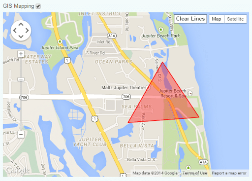
How Geofencing Works for Emergency Notifications
A geofence is a virtual perimeter for a real-world area. Think of it as a digital tripwire. It allows a communication system to know exactly when and where to trigger a specific protocol.
Static vs. Dynamic Geofences
A static geofence might be a permanent border around a school campus, a hospital, or a corporate headquarters. In emergency response, these are used for “always-on” situational awareness.
For instance, a hospital might maintain a static geofence to automatically alert security personnel or activate digital signage the moment a known emergency vehicle enters the property. The trauma team is then prepped before the ambulance doors even open.
A dynamic geofence, on the other hand, is one created on the fly to respond to something like a moving police pursuit or a spreading gas leak. These are essential for active response because they move as the threat moves.
If law enforcement is pursuing a suspect through a city, the dispatch team can shift a dynamic geofence along the chase route, automatically sending “Lockdown” or “Stay Indoors” alerts to residents just two blocks ahead of the pursuit. At the same time, the team can clear alerts for the neighborhoods the suspect has already passed.
Trigger-Based Alerts
Advanced systems can trigger alerts the moment a device enters or exits a zone. For example, if a student enters a lockdown zone, their phone could automatically receive safety protocols without an operator having to manually look up their number.
Or if a maintenance worker enters a geofenced danger zone near a high-voltage failure, the system can trigger an immediate warning to their mobile device before they get close enough to be injured.
What Are Dynamic Boundaries and Why Do They Matter?
Emergencies aren’t stationary. A wildfire shifts with the wind. A flood crests and moves downstream. This is where dynamic boundaries save lives.
Standard alerts are often stuck in rigid shapes like zip codes or county lines. Dynamic boundaries allow managers to expand, shrink, or shift alert zones as the situation changes. Alert fatigue reduces, emergency response routes stay clear, and unnecessary panic doesn’t spread.
Wildfires: As the fire jumps a ridge, the alert zone moves with it.
Floods: As water recedes in one area and rises in another, the “Evacuate Now” zone is updated in real-time.
Chemical Spills: Depending on the wind, a boundary can be drawn to match the predicted path of a toxic cloud.
Real-World Use Cases for Geo-Targeted Emergency Alerts
Schools and Campuses
Notifying only the buildings near a specific incident rather than scaring the entire student body. This keeps key evacuation and first responder routes clear.
Urban Evacuations
Managing foot traffic during a gas leak by alerting residents block-by-block. Unaffected businesses stay open, and emergency resources aren’t blocked by traffic.
Severe Weather
Delivering tornado warnings only to those in the polygon area defined by the National Weather Service, containing unnecessary panic.
Infrastructure Failures
Alerting only the homes affected by a specific water main break.
Public Events
Providing safety updates to people at a stadium or festival without bothering or risking warning fatigue for the rest of the city.
Best Practices for Using Geo-Targeted Alerts
Start a Little Wide: It’s better to start with a slightly larger boundary to make sure no one on the edge is missed.
Keep Updating: An alert that was spot-on an hour ago might be useless now. Update your dynamic boundaries constantly.
Keep it Actionable: Don’t just say there’s a problem. Give specific directions based on that location.
Use Every Channel: Combine geo-targeting with SMS, voice calls, and social media.
How DialMyCalls Supports Targeted Emergency Alerts
Managing a crisis is stressful enough. Your software shouldn’t make it harder. DialMyCalls is built to handle the heavy lifting of precision notifications so you don’t have to.
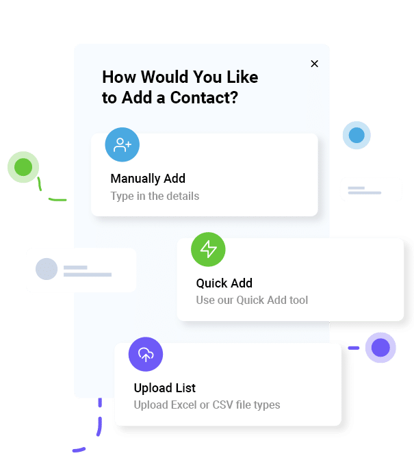
Targeted Contact Lists
Easily segment your audience based on location data.
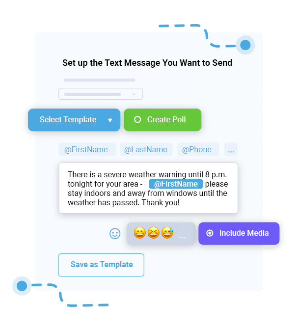
Rapid-Fire Delivery
When seconds count, our infrastructure ensures your alerts go out instantly.
Draw your zones, hit send, and get back to managing the situation.
Conclusion
At the end of the day, emergency communication is about getting people the information they need to stay safe. Moving away from blast broadcasts and toward geo-targeted precision is a huge step forward for public safety.
Ready to make your notifications smarter? We can help you set up a geo-targeted contact list for your organization today.
Emergency Alerts FAQs
What are geo-targeted emergency alerts?
Notifications sent specifically to people within a defined geographic area.
How does geofencing work?
It creates a virtual boundary that triggers alerts for those inside it.
What is the role of GIS?
It’s the mapping tech that lets managers visualize risks and real-time hazard data. In a school or university setting, GIS allows campus security to see exactly which buildings are in a danger zone based on a gas line’s proximity. For healthcare organizations, it helps facilities managers identify which satellite clinics are within a projected hurricane path to prioritize medical supply evacuations. For municipalities, GIS can overlay public utility maps with topography to predict which specific residential streets will experience flash flooding. Rather than city-wide panic, evacuation orders become precise.
Why are dynamic boundaries important?
They allow alert zones to move as threats like fires or floods move. Managers can expand, shrink, or shift alert zones as the situation changes. Alert fatigue reduces, emergency response routes stay more clear, and unnecessary panic doesn’t spread.
Do geo-targeted alerts reduce alert fatigue?
Yes, by ensuring alerts are only sent to those in actual danger.
Are these alerts accurate?
Yes, modern systems use GPS and network data for high precision.
Ryan Betancur is an Emergency Management Planner at Hagerty Consulting and a proud US Army veteran. Drawing on years of experience, he specializes in healthcare and critical infrastructure emergency management, strategic planning, and business continuity. Ryan has been on the front lines managing COVID-19 responses in New Jersey and Illinois and supporting NYC's Migrant Crisis response. He holds a master's degree in Homeland Security and Emergency Management and multiple certifications in emergency preparedness.
“I am a youth minister and have spent hours in the past calling students individually to remind them of an upcoming event or to get out an urgent announcement. With DialMyCalls.com, I cut that time down to about 1 minute. I also love how I can see exactly who answered live and how long they listened so I know if they heard the whole message. DialMyCalls.com is the best website I have stumbled upon all year! Thanks!”
Real Results, Real ReviewsOver 40,000 customers trust our platform – and it shows.
4.3
502 Reviews
4.7
836 Reviews
Author
Ryan BetancurEmergency Management Planner
Ryan Betancur is an Emergency Management Planner at Hagerty Consulting and a proud US Army veteran. Drawing on years of experience, he specializes in healthcare and critical infrastructure emergency management, strategic planning, and business continuity. Ryan has been on the front lines managing COVID-19 responses in New Jersey and Illinois and supporting NYC's Migrant Crisis response. He holds a master's degree in Homeland Security and Emergency Management and multiple certifications in emergency preparedness.
“I am a youth minister and have spent hours in the past calling students individually to remind them of an upcoming event or to get out an urgent announcement. With DialMyCalls.com, I cut that time down to about 1 minute. I also love how I can see exactly who answered live and how long they listened so I know if they heard the whole message. DialMyCalls.com is the best website I have stumbled upon all year! Thanks!”
Fill out the form below to get a fast custom pricing quote specific for your
organization.Want to speak to our sales team now? Call us at
1-800-928-2086
Thank you!
A representative will be reaching out to you soon.
For immediate help you can call us on
800-928-2086.
Try Out DialMyCalls Now?
Enter a new password and click create account and you'll be able to send 25 test messages now.
Send A Sample Broadcast
We'll send a sample call or text to your phone right now. Remember when you use DialMyCalls you can record your message in your own voice. When the phone rings just pick up and say "Hello" to hear the message.